--------------------------------------------------------------------------------------------------------------------------

THE DUMBARTON ROAD PROJECT
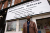
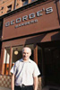
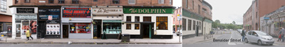
The Dumbarton Road Project documents the streetscape & people of the Partick area of Glasgow, Scotland Ian Buckland |
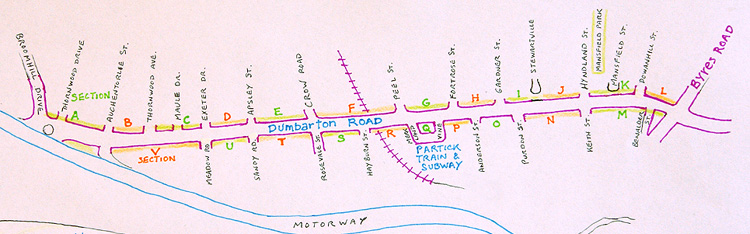
The area covered by the project :
* click on the images below to see the larger version in a new page
* MOVE THE SLIDER AT THE BOTTOM OF THE FRAME to MOVE ALONG THE PHOTO
. . . . . . . . . . . . . . north side of Dumbarton Road . . . . . . . . . . . . .
Section A - Broomhill Drive to Auchentorlie Street
![]()

Section B - Auchentorlie Street to Thornwood Avenue


Section C - Thornwood Avenue to Exeter Drive


Section D - Exeter Drive to Apsley Street

Section E - Apsley Street to Crow Road
![]()
Section F - Crow Road to Peel Street
![]()
![]()
Section G - Peel Street to Fortrose Street

Section H - Fortrose Street to Gardner Street

Section I - Gardner Street to Stewartville Street


Section J - Stewartville Street to Hyndland Street


Section K - Hyndland Street to Dowanhill Street

Section L - Dowanhill Street to Byres Road

. . . . . . . . . . . . . . south side of Dumbarton Road . . . . . . . . . . . . .
Section M - Beith Street to Keith Street


Section N - Keith Street to Purdon Street
![]()

Section O - Purdon Street to Anderson Street

Section P - Anderson Street to Vine Street

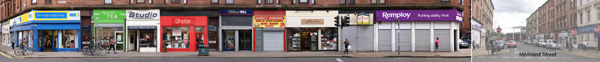
Section Q - Vine Street to Merkland Street

Section R - Merkland Street to Hayburn Street

Section S - Hayburn Street to Rosevale Street


Section T - Rosevale Street to Sandy Road

Section U - Sandy Road to Meadow Street

Section V - Meadow Street to Clydeside Expressway


--------------------------

IAN BUCKLAND.COM
PHOTODOCUMENTARY ARTIST
Email : ian@ianbuckland.com
--------------------------------------------------------------------------------------------------------------------------